Showing posts with label Rainbow. Show all posts

Sunday, October 17, 2010

Back and forth

Three days without discomfort = reason to be optimistic. I credit ibuprofen, a second, more rigorous and productive massage in Mammoth (I took it as a really good sign that my therapist was working on Meb later in the day--"your competitor," she said--we laughed), and ice bathing in the local creeks. Sitting in the waters (I've tried Mill Creek now, too), I start to imagine myself a boulder or root wad. Creek bubbles bounce around my legs, and catch in my quivering hairs. Yellow cottonwood leaves wrap around and stick to my thighs. If only I could stay in longer than 15 minutes (without fear of hypothermia), I could be all gold in a few weeks.

I have to admit I was pretty surprised/overjoyed Friday when I was able to jog 60 minutes without any symptoms. I started with a mile or so of walking in Mono City, then, to attempt a run, I drove a short ways to the relatively flat stretch of Hwy 167 between 395 and Wilson Creek. Most unfortunately, this stretch is less than a mile long, so I felt a bit like a rotisserie chicken turning under the cold fall sun, as I jogged back and forth. I was also holding my breath, as it were: trying to stay focused on my form, keep from speeding up, and stay alert for any sign of ITB unrest. The ice age tufa that stand in a row across the road, like hulking linebackers, proved worthy distraction--they have for months now. They're such interesting shapes--a natural Japanese rock garden. (Zen football players?) I called it a day after 60 minutes, about 4.5 revolutions, and headed down to Mammoth for a session of "bodywork."

Yesterday, I did the same, but 5.5 revolutions worth. Today, for adventure, I drove to mile ten on Hwy 167, where there's a relatively flat 5-mile stretch. It rained off and on much of the day, so by heading east I also may have avoided a few more droplets. After parking, walking, and starting up, I ran at just under 7 min pace to the "MONO 167 12.5" mile sign, u-turned to the 8.5 mark, etc, etc. Though I haven't been running fast, perhaps psychologically this straight and narrow pavement running has helped prepare me for the long blocks of NYC. And it was stormily gorgeous out there, however chilly. The Sierra was draped with raincloud, but the sun seared through, briefly, in scattered rays and, as I drove away, rainbows.


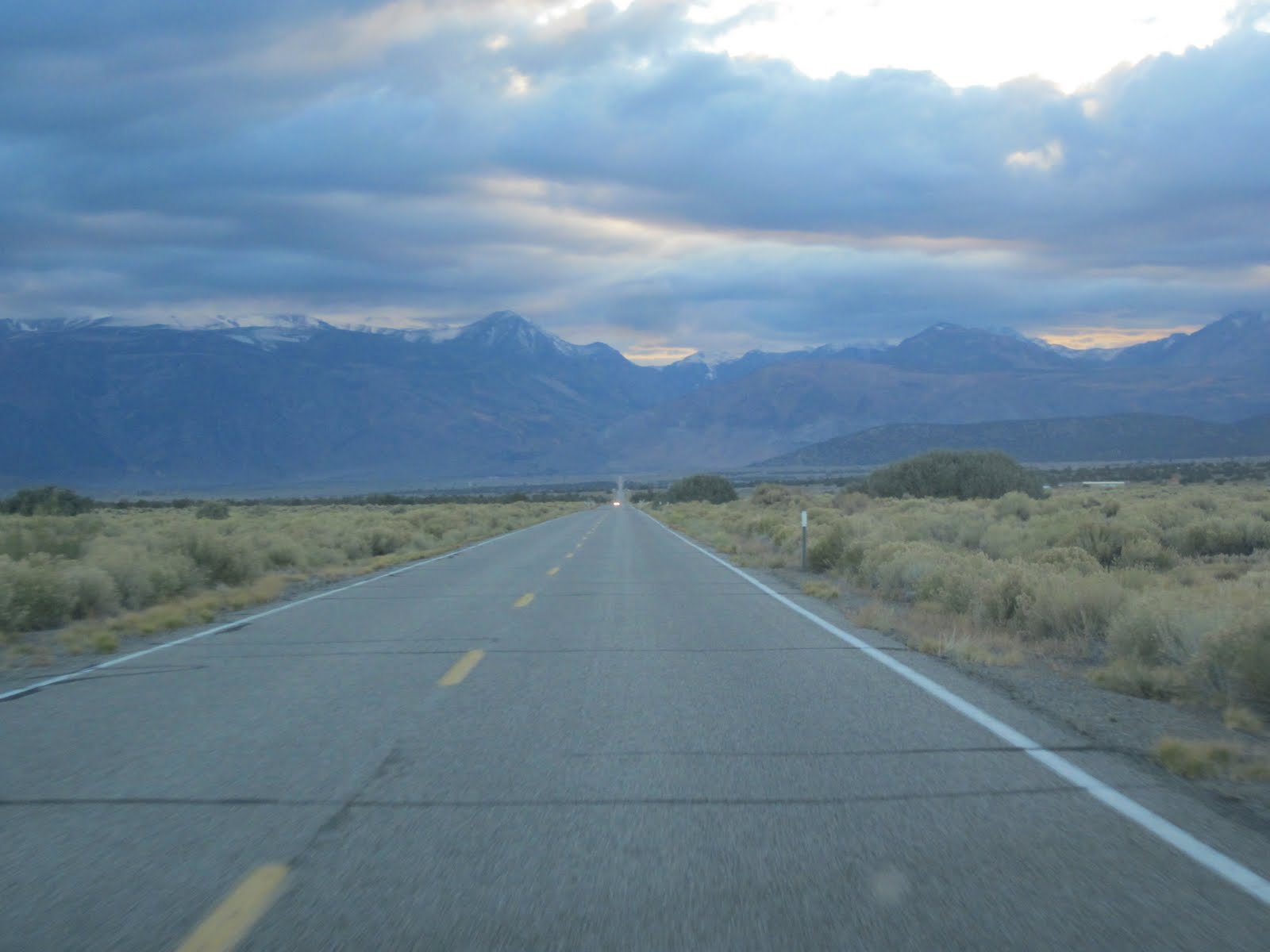
I think I'll always remember Hwy 167 as my injury runway. When I had a pain near my achilles in late June-early July, I ran out and back on it ad nauseam. Then, I was after the pavement--to avoid sand. I suppose I still am, but I'm more concerned with flat terrain--no rocks, and little grade--and there's not much around the Basin beyond 167, other than 395. Tomorrow, however, I might try a hill or two, and maybe stray off asphalt. I hope to try a workout of some sort mid-week.

---
10 mi, 70 min; Hwy 167 from the 10 mile marker

Week Total: 37 mi/4 days

Saturday, 10/16: 10 mi, 75 min; Hwy 167, close to home

Friday, 10/15: 8 mi, 60 min; Hwy 167, close to home

Saturday, July 31, 2010

Disneyland

So, there's this wonderful development, just across 167 from Mono City. Why is it wonderful? Because it failed to develop. Out in the middle of the sage, on the West side of Goat Ranch Cutoff (the road's in two parts, divided by Wilson Creek), 7 or 8 big houses sit lonely, like ice age tufa. A new, low sign at the turn says Rainbow Ridge Realty, June Lake--it's no ridge, but I bet they do get killer views of 'bows over the Basin through their tall glass windows.

The roads in this stalled (for now) development which have the houses on them are in pretty decent shape. But get this--there's a small network of house-less lanes between them, complete with cul-de-sacs, which is quickly being reclaimed by the desert. The pavement is broken at regular intervals, and rabbit brush and sage have filled the cracks. Streets with names like Conway Rd, and Glacier Rd, are announced on weathered signs at pointless, dead end junctions--here, there is such a thing. When I run through this place, I would feel like a member of the legendary "Steeple squad!" leaping over these rows of bushes, except that, being tall, I hardly have to leap.

It's an experiment in what lasts, what doesn't. I wonder how often all the other roads around here have to be repaved to stand a fighting chance against the elements. And desert plants, why, they're downright vicious! Their gnarled taproots go 15, or 50 feet into the ground, in search of a hint of water. You think a pancake thin spread of pavement's going to keep them down? They root with vengeance.

Anyway, I began running through this bizarre landscape, a ghost-almost-town, because a) when I was dealing with real/potential injury, I wanted to avoid sand while staying near Mono City b) running mindlessly down short cul-de-sacs and dead end streets is a super way to eschew long stretches of head-on wind, and so stay fresh (sort of--purposeless running can run you down, too), and c) nothing tickles me more that thwarted suburbia. It's a runner's Disneyland.

---
8 mi, 56 min; a ramble through the Conway Ranch development, 167, and the sage aside Mono City -- maybe I'll call this run "Disneyland"?

Friday, July 30 -- AM: 9 mi, 63 min; "inner Dechambeau loop" from County Park -- PM: 4 mi, sagebrush ramble by Mono City

Thursday, July 29 -- 10 mi, 70 min; 167 to Cemetery Road

Saturday, July 24, 2010

Fire in the hills

Around 10am, I went out for a tour around Conway Ranch. Some entity with bulldozers--the County, I assume--has widened what was a perfect jeep trail. Now, the road is roughly graded, and the sage has been torn up and crushed along the edges and pushed into isolated pyres that will probably go unburned for years. Seems like a quintessential case of work for the sake of work--there's absolutely no reason, to my mind, why this road needed to be "improved." It might see a car, or two, on a good day. In any case, as you can probably tell, my aesthetic and environmental self (and economic, such as it is) found the change irritating. Pretty strange to see orange Slow, Work Ahead signs in the middle of nowhere. I did not slow, but I wasn't going fast, either.

Had thought about going for a moonlit double, but it didn't pan out after my South Tufa tour and store shift, which ended at 9:30pm. Too late. But the basin just started "pop'n" with rainbows and brilliant light before dusk after scattered thunderstorms much of the afternoon. People were pulling over on the side of the highway to snap pictures of the 'bows, and the Mono Craters were going on and off like Chinese lanterns strung toward Mammoth. Also, a lightning strike kindled a sizable fire in the Bodie Hills, which mushroomed a spectacular, billowing cloud high into the air (allowing me to imagine what a volcanic eruption might look like beside the lake). Added further drama to an already unbelievable landscape. We'll see how long it continues to burn ...

---
9 mi, 63 minutes; Conway Ranch Loop, without the Goat Ranch Cutoff ext.

Friday, July 16, 2010

The pineapple

Put off the run until evening, because, for the first time this summer, the basin threatened to storm all day. Gray, curling clouds came with the light, and lightning came from them before long.

But at last, before dusk, a window cracked, the lightening acquiesced, and I strided over firm pattered sand to Dechambeau Ponds from Mono City, straight toward the arc of a rainbow not quite bridged at its height, for the clouds truncated its color. First the bow was more (most!) vibrant to the right of Black Point (to the west), then the column dissipated and what was left, to my left (to the east), glowed stronger, as if it had absorbed all that energy. It appeared as if the rainbow was shifting, softening, but it was me, maneuvering it. Erelong, I hope to research the science of rainbows (beyond the basic middle school experiments), so I can really chase them.

I will say, though, that there's something about an arch ahead--a tunnel, an entrance to forest--that quickens the step. I can't explain it, except to theorize that a frame does for a runner what it does for a painting: contains, focuses, draws forward. This, I reason, is why races often end below an arch of balloons or a metal scaffolding (the clock atop helps, too). When I was in college, my team used to race in practice toward "the pineapple" (actually a pine cone, I think; we debated this point often) hanging from a patinated arch on Federal Hill in Providence whenever we took that route. I don't think it was the fruit, but its stem, that was the catalyst. (Thoughts guys?)

Anyhow, it was a tad more arduous on the return tonight. Could be because the rainbow had disappeared. Could be because it was uphill. Added-on a smidge at the end.

---
12 mi, 84 min; around Dechambeau Ponds from Mono City (a good keyhole loop)

Wednesday, July 7, 2010

Spinning like a top

Seems to be a week of afternoon thundershowers, but none on the north side of the lake have truly let loose so far. The views here are such that you can see whole systems of clouds hanging, and moving, over Mono, with trails or frills of rain sizzling to vapor far before they have a chance to hit the ground.

I was thinking, today, about how the phrase "in the distance" is so confused in the Basin. Black Point, with its fissured cap, is in the distance, but within reach of a run from home. The south shore is a 20 minute drive. The high Sierra over Mammoth Lakes is clear, crisp, most days, though its 40 miles distant. Unlike, say, in the forested suburbs of New England, here distance running is, visually, immensely satisfying (even the same loop looks dramatically different depending on how the light's playing on, landing on, various (mountain) ranges of distance), but it makes me feel like a top spinning on a vast, arid table. Multiple thunderheads vying, in their windy way, for position over the lake has the same, personally diminishing effect. It's easier to feel fast, and large, when you don't look up!

A short, loosely related story: yesterday, climbing back up to Mono City on the jeep trail that heads to Black Point (sorry, I really need to come up with nicknames for them all), I just happened to turn around, and there was a soft rainbow against the dark, vaguely mauve Nevada distance. It had materialized out of the low, lit blue sky that slipped between the crescent of rock and cloud at the head of Lundy Canyon (up from Mono City) just after 8 pm. I had been running away from it, and I may have never seen it, if not for a chance crane of the neck.

Anyways, coming into home, there was a neighbor standing in the sagebrush on the side of E. Mono Lake Drive with a camera looking in the direction from which I'd come. I glanced back to see the bend of colors, but they were gone.

"Did you get the rainbow?" I asked. "Barely," he said. I nodded, and thought to myself, "Me too."

Something else, to finish: I passed a FedEx tractor trailer on the mile of 395 I ran today (rather, it passed me, emphatically). I speculate it was the very same truck, and driver, at the same hour, as yesterday, on its daily route--something you could set your timepiece to, should the sun be obscured. Presumably he wasn't hauling the same goods, though--at least, not the very same.

---
9 mi, 63 min; Conway Ranch-Hwy 167 loop, slightly abbreviated, for lack of energy (and sleep last night)

Also: An HCN blog post on wolves in Oregon: Jumping (to) the gun